
Explainer Public services · Virginia
Your address is public-safety infrastructure: what Virginia’s next-generation 911 map needs
Road centerlines, address points, jurisdiction boundaries and caller information must agree closely enough to route help. Residents can fix an address problem without pretending to manage dispatch.
Checking whether this browser can read the story aloud.
Explore related topics
Sources & editorial review
Sites editorial review recorded for this exact revision. This AI-assisted article or learning resource includes source links and credited contextual imagery.
This is a local editorial review, not a canonical Cultural Imprint Engine assessment. No CIE score is claimed. Source review does not verify third-party playback, provider availability or image pixels.
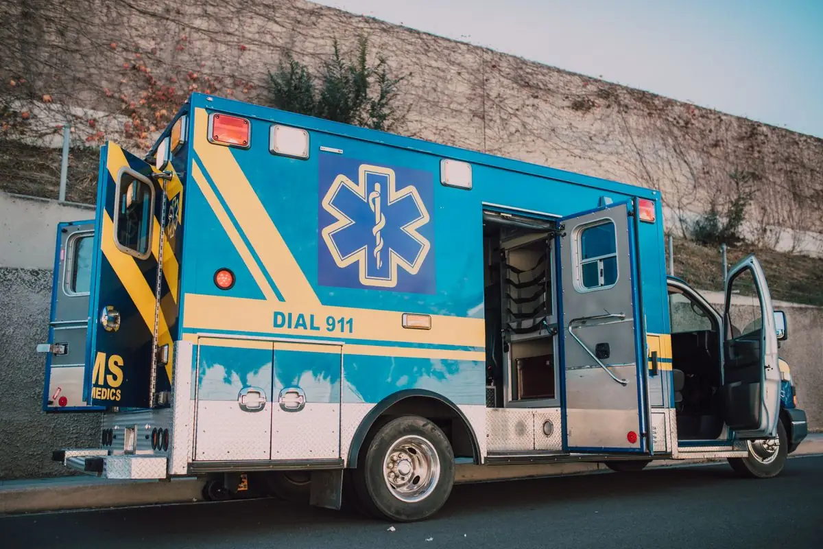
Photograph · source and license
The image, credit, reuse license, editorial context and delivered file are recorded in the exact Sites editorial review. This review is separate from the article’s canonical CIE assessment.
Image and publication standards →In this story
An address is more than mail
In Next Generation 911, geographic data helps route emergency communications to the right public safety answering point. Virginia’s geographic program works with locality-maintained road centerlines, address points, parcels, building footprints and boundaries.
The number on a mailbox is therefore connected to a maintained data system, even though postal delivery, taxation and emergency addressing can use different records.
During an emergency, call or text 911 according to local capability and dispatcher instructions. This article is not a dispatch guide.
It explains how to notice and report an ordinary address-data mismatch before a crisis. Never test a correction by placing a false emergency call.
The point must connect to a named road
An address point represents a structure or service location, while a road centerline carries the street name, ranges and other attributes used in routing. If spelling, direction, community name or range logic differs, automated validation can flag an error.
That does not mean responders have no local knowledge; it means the digital chain needs reconciliation by the authorized data owner.
Private drives and shared entrances complicate the picture. A sign at the highway may serve several structures, while each structure needs its own assigned address.
Residents should use the locality’s addressing office and avoid inventing suite or unit identifiers that have not been assigned. A delivery app accepting a label does not make it an official emergency address.
Jurisdiction boundaries affect routing
A town can sit inside a county while services are divided by agreement. Boundaries in the 911 system need to reflect the answering point and response framework, not simply the name residents use for the community.
A mailing city can differ from the incorporated town or county that owns the address. That difference is normal, but it should be understood when a form asks for jurisdiction.
Virginia’s statewide NG911 work connects 125 local government centers to a modern emergency-services network. State coordination does not eliminate local stewardship.
Localities still maintain core geographic records and resolve the real-world changes that a statewide system cannot discover on its own.
A new road or building creates several updates
Construction may require a road name, address assignment, parcel update, building point, utility connection and certificate. Those events occur on different schedules.
A house can physically exist before every public viewer refreshes. The responsible office can say which address is official and whether a delay is a display issue or a missing assignment.
Keep the assignment letter, permit reference and effective date. When contacting a map provider, state whether the error appears in the locality’s official record, a commercial navigation app or both.
The locality cannot directly edit every private map, and a private vendor’s correction does not change the official record.
Signs are the visible end of a data process
A clear road sign and visible address number can help responders, but sign placement, format and maintenance requirements belong to the locality and road owner. Do not install an unofficial road sign that could create confusion.
If a sign is missing or damaged, report the exact location through the published non-emergency route.
Photograph the condition from a safe and lawful place and note direction of travel. Do not stand in a roadway or publish a vulnerable resident’s access details.
The goal is to give the owner enough information to verify the issue, not to create a public map of gates, keys or medical needs.
Caller location adds another layer
Wireless and text systems can provide location information, but accuracy varies with technology and conditions. An address spoken or typed clearly remains important when possible.
Voice over internet and multi-line systems can also depend on registered location information. Households and organizations should follow their provider and locality guidance rather than assume the device always knows the correct room or building.
An apparent location error during a real call should be documented through the agency’s appropriate follow-up process after the emergency. Public reporting must protect caller and patient privacy and should not publish audio or identifying data without authority.
A single account can identify a question; system conclusions need corroboration.
Report ordinary errors through ordinary channels
For a non-emergency mismatch, collect the official address document, parcel or permit reference, screenshot with retrieval date and a plain description of what is wrong. Contact the locality office responsible for GIS or addressing.
If the official record is correct and only a commercial service is wrong, use that service’s correction process as well.
Do not send identity documents or access codes through an unverified email address. Ask what evidence the office needs and how it protects submissions.
Record the case or ticket number. If the correction affects neighbors, each household should confirm its own assigned address instead of copying one person’s result.
Public data does not erase security boundaries
Road and address layers can be public, but operational dispatch details and personal information may be restricted. A newsroom can explain the data model without mapping current unit locations, vulnerabilities or private medical needs.
Requests for records should be scoped to the public purpose and should not burden the agency with unnecessary personal data.
Similarly, a map error should not become a claim that someone intentionally denied service. Data can lag, records can conflict and commercial vendors can differ.
Seek the owner of each layer, offer a fair opportunity to explain and correct the record when stronger evidence arrives.
The resident’s durable address file
Keep the assignment notice, a current map, road-name documentation and relevant permits together. Add the non-emergency correction contact and the date the file was checked.
Landlords and property managers should ensure occupants know the official unit designation. After renaming, display the new address as required and update important accounts through secure channels.
That file cannot guarantee routing or response time. It can reduce one source of ambiguity and give officials a clean record when something conflicts.
Public-safety infrastructure depends on agencies, technology and residents maintaining the same basic facts with care.
What the public record supports
Virginia’s sources establish that NG911 relies on accurate GIS layers and that locality data feeds statewide coordination. The law establishes 911 as the emergency number and addresses text capability.
Those sources do not establish that a named address is wrong or that an answering point mishandled a call.
A future investigation would require the specific address history, authorized call records, data-owner response and applicable privacy review. Until then, the useful publication is a clear correction path: verify the official address, identify the layer displaying the error, contact its owner and preserve the outcome.
Sources & verification
Official description of locality-maintained base layers and statewide coordination.
Read the sourceOfficial program description for statewide emergency telecommunications and GIS support.
Read the sourceFederal institutional guidance on NG911 GIS and planning; not a local dispatch record.
Read the sourceOfficial law for the designated emergency number and text-to-911 requirements.
Read the sourceThis article was written with AI assistance from the linked sources. No firsthand interview or visit is implied. Source dates and limits are identified in the reporting. Advertising does not determine editorial coverage. Request a correction or read our standards.
EVERY NEIGHBOR HAS A VOICE
Keep the conversation going.
Share experiences, ask questions and link evidence for factual claims. Automated publication checks apply to each submitted version. Comments are independent community discussion, not submissions to a government body.
Sign in to join · freeCommunity standards