Explainer Sports · County
Why the water can move so much during a Leesville fishing trip
The reservoir’s role in a two-lake power system shapes fishing, access and the information anglers should check.
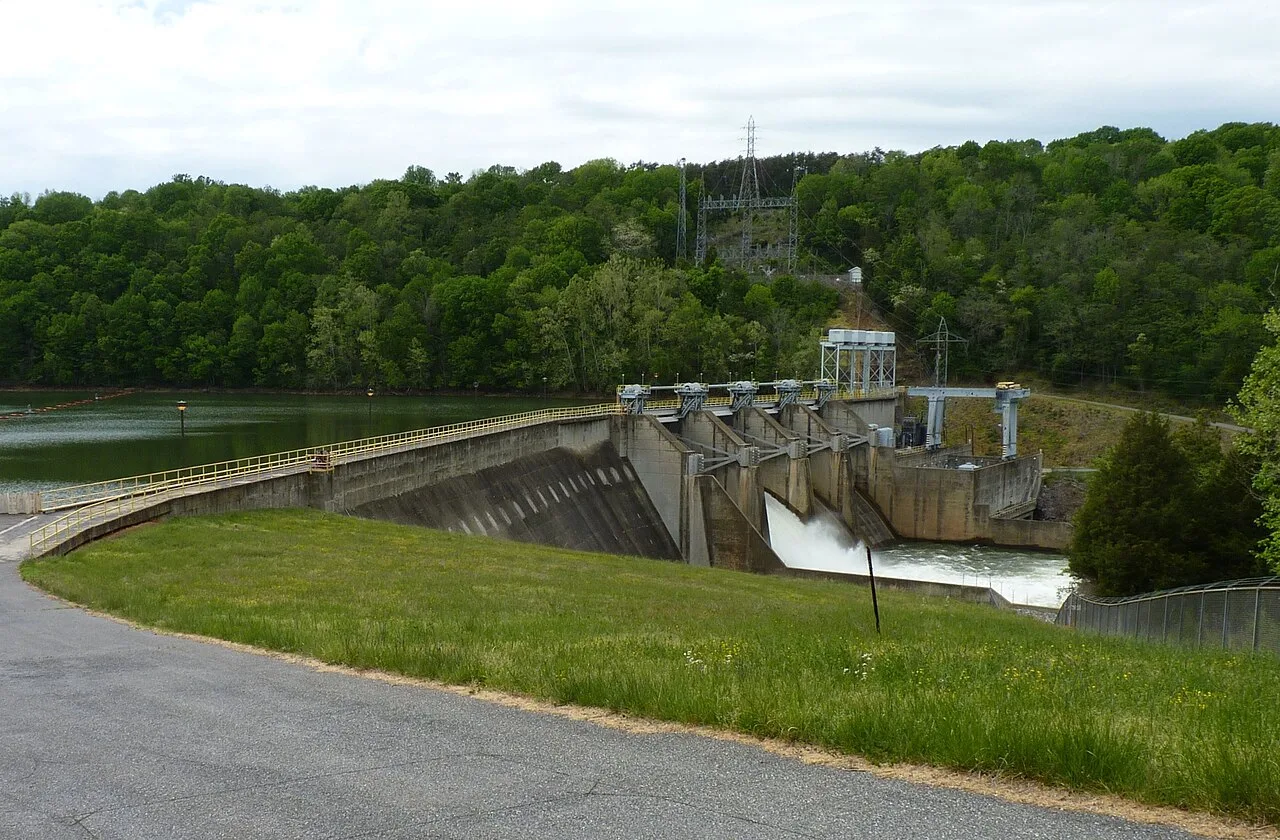
Image provenance · CIE 100/100
Assessment applies to the credited image record and its editorial context. Image delivery and the pictured event’s current status are not certified by a score. Receipt: 02c3446b-1e0b-47a6-9e5c-5e0c5afdff8d
Image & publication standards →At a glance
- Leesville is the lower reservoir in the Smith Mountain pumped-storage system.
- DWR reports substantial daily water-level changes and routine floating debris.
- Lake elevation, river flow and a boat ramp’s condition answer different questions.
In this story
A lake with another job
Leesville Reservoir sits across the Pittsylvania, Campbell and Bedford county boundaries, close enough to be a familiar fishing choice for Gretna-area residents. Its shoreline is also part of an operating power facility.
Virginia DWR describes a reservoir managed for hydroelectric generation and for returning stored water to Smith Mountain Lake.
That job explains an important feature of the fishing experience. DWR reports daily water-level changes ranging from one to 10 feet and warns boaters to watch for floating debris.
Its fishery overview describes different conditions in the upper and lower portions of the reservoir, with largemouth bass among the principal attractions. Those observations describe the waterbody; they are not a prediction of what any angler will catch.
Follow the exchange between the lakes
Appalachian Power’s Smith Mountain Project explains that water released from Smith Mountain Lake generates electricity as it moves into Leesville. Water can then be pumped back to the upper reservoir.
The operator publishes a Leesville operating range of 600 to 613 feet in elevation and explains that a one-foot change in Smith Mountain corresponds to about 6.5 feet in Leesville.
These are descriptions of how the system operates, not instructions to expect a particular elevation at your launch time. A shoreline photograph from yesterday can therefore be a poor guide to today’s access.
Before setting out, check the operator’s current lake-level page and the notice date, then assess your intended launch directly.
Read the right measurement
AEP’s water-level and flow page separately reports project inflow, Leesville discharge and river-gauge observations. These are useful distinctions: reservoir elevation describes a water surface, while a flow figure describes water moving through the system or past a measuring point.
A downstream gauge is not a measurement of depth at a lake ramp.
For a practical trip plan, record the access point, anticipated return time and where you will check updated conditions. DWR identifies public ramps and a fishing pier near Leesville Dam in its facility information.
Choose an alternative outing if conditions at the intended site do not fit your boat or experience. Before keeping fish, consult current species-specific regulations through DWR; this explanation does not reproduce a catch-limit table.
Keep the current rule page available so the person handling the catch has the same information as the person planning the trip.
Cultural & community review
Assessment passed This recorded version passed its cultural and community assessment.
- Reviews the cultural and community context of this editorial item.
- Source, rights and publisher checks remain separate.
- It does not score people or certify every fact.
Read the assessment record & limits
- This record applies to the identified content revision. Later changes require another assessment.
- Asset
- gj:article:leesville-reservoir-water-moves-fishing-guide-2026
- Engine
- ct.algorithm.cie.v1 · 1.0.1
- Receipt
- 28fd7e4c-5872-410b-b5d5-242d38fad098
- Assessed
- Revision
- sha256-e1c04bb93eda9980b75a82b8667d6f03a7fddf7c0f54cf83afbdfd0e07b19f13
- Record state
- eligible · PASS
- Binding
- BOUND
Sources & verification
Undated; checked September 7, 2026. Official reservoir overview, daily fluctuations, debris, fisheries and facilities; linked biological report is dated 2021.
Read the sourceUndated; checked September 7, 2026. Operator explanation of reservoir ranges and pumped-storage exchange; no live reading reproduced.
Read the sourceChecked September 7, 2026; fetched plant notice reports September 6, 2026 observations. Used for measurement categories, not represented as September 7 live conditions.
Read the sourceThis article was written with AI assistance from the linked sources. No firsthand interview or visit is implied. Source dates and limits are identified in the reporting. Advertising does not determine editorial coverage. Request a correction or read our standards.
EVERY NEIGHBOR HAS A VOICE
Keep the conversation going.
Share experiences, ask questions and link evidence for factual claims. Automated checks assess each version; posts that pass publish immediately with their CIE score and reasons. Comments are independent community discussion, not submissions to a government body.
Sign in to join · freeCommunity standards