
Feature Home & place · Virginia
South Boston’s warehouses show how a working town can keep changing uses
The historic district connects tobacco commerce, rail access, Black neighborhoods and adaptive reuse—evidence for reading place without freezing it in one prosperous era.
Checking whether this browser can read the story aloud.
Explore related topics
Sources & editorial review
Sites editorial review recorded for this exact revision. This AI-assisted article or learning resource includes source links and credited contextual imagery.
This is a local editorial review, not a canonical Cultural Imprint Engine assessment. No CIE score is claimed. Source review does not verify third-party playback, provider availability or image pixels.
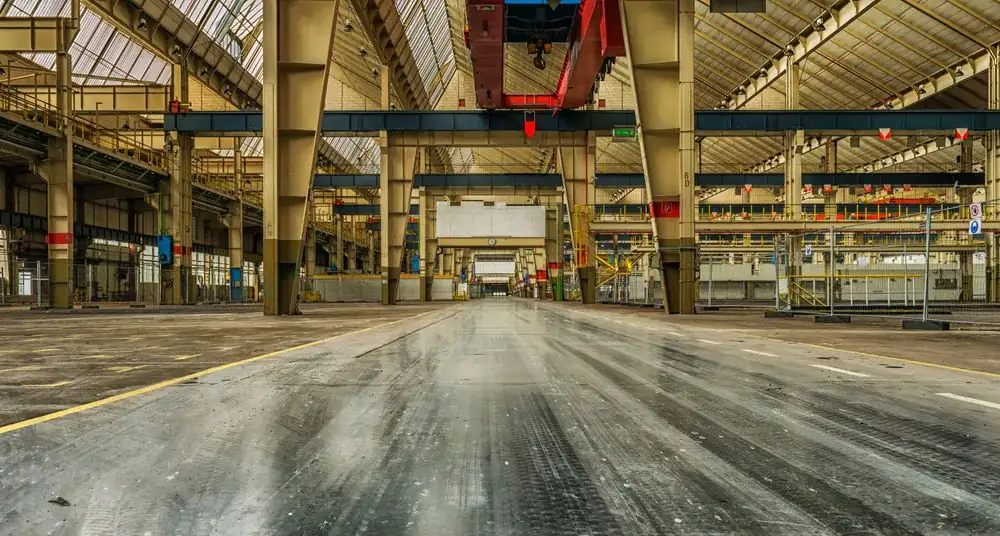
Photograph · source and license
The image, credit, reuse license, editorial context and delivered file are recorded in the exact Sites editorial review. This review is separate from the article’s canonical CIE assessment.
Image and publication standards →In this story
A town shaped by movement and markets
The Virginia Department of Historic Resources describes South Boston’s historic district through industrial, commercial and residential development after the Civil War. Rail connections and the bright-leaf tobacco trade helped make the town a major market.
Warehouses, prizeries, commercial blocks and houses record the physical relationships among crop, transport, finance, processing and labor. That landscape is more informative than a single landmark because it shows how activities clustered.
Farmers and buyers needed sales space; firms needed storage and handling; workers needed homes and services; rail lines connected the market to wider networks. The district therefore reads as an economic system built into streets and buildings.
Prosperity was real and uneven
Tobacco generated wealth and civic growth, but a complete place history must ask how benefits and burdens were distributed. Agricultural labor, warehouse work and domestic service carried different risks and status.
Segregation shaped housing, schools, commerce and public life. The district’s later boundary work includes areas important to African American history, helping prevent the town’s story from being told only through prominent businesses and large houses.
Preservation records are strongest when readers treat them as an entry point rather than a complete social history. Property files may document architecture well while leaving workers, tenants and informal community institutions less visible.
Those gaps should be named and researched, not filled with invented anecdotes.
Reuse changes meaning without erasing origin
Former industrial buildings in South Boston now support educational, cultural and community uses. The Southern Virginia Higher Education Center describes its campus in repurposed textile and tobacco warehouses, while the Prizery occupies a building tied to the tobacco economy.
Adaptive reuse can retain massing, materials and neighborhood memory while giving an obsolete facility a viable function. It can also create new public access to places once organized around private commerce.
Reuse is not automatically preservation success: projects must address structural safety, accessibility, environmental conditions, financing and a sustainable program. The best evaluation asks what fabric was retained, what was changed, who can use the building now, and how honestly the new use explains the old one.
A district is not a museum fence
Historic designation recognizes significance and can shape review or incentive eligibility, but the district remains a place where people live and work. Buildings age, businesses change and households need safe, efficient spaces.
Preservation policy must therefore handle change rather than pretending change can be stopped. Residents deserve clear distinctions between state or national register status, local design review, private ownership and public access.
A listed building is not necessarily open to visitors. A district map is not a finding about a particular parcel’s condition.
Anyone considering work should consult the responsible local office and current rules before relying on a summary. Respecting occupied properties is part of respecting history.
How to read South Boston on foot and on paper
Start with DHR’s district record and map, then compare the industrial core, commercial streets and residential areas. Notice rail alignments and the scale of warehouse structures.
Use public rights-of-way and posted visitor information; do not enter private or restricted property. Pair the built environment with institutional histories and, where available, consented oral histories from workers and neighborhood residents.
For a present-day visit, confirm hours and accessibility with each destination. The most useful conclusion is not that South Boston should return to a tobacco past.
It is that the town’s buildings hold evidence of how regional agriculture, transportation, race, labor and investment shaped a place—and how thoughtful reuse can keep that evidence available while serving current needs.
Housing belongs in the industrial story
Warehouses dominate photographs, but workers and their families needed places to live. Residential streets reveal class differences, access to transportation and the relationship between industrial schedules and domestic life.
Larger owners’ houses, modest worker housing and Black neighborhoods should not be interpreted as parallel decorative styles; they were connected through labor and unequal opportunity. Changes in industry affected rents, maintenance and household stability.
Preservation surveys can identify building age and form, while census records, deeds, maps and oral histories add occupants and movement. Combining those sources keeps home from becoming a picturesque footnote to business history.
Public benefit should be stated, not assumed
A reuse project may preserve architecture and still produce little access for longtime residents. Evaluation should ask whether the building offers education, jobs, cultural space, affordable services or another documented benefit; how public money or incentives are used; and what obligations follow.
It should also ask who participates in interpretation and whether displaced or segregated communities appear in the story. These are governance questions rather than reasons to reject reuse.
Clear goals allow residents to distinguish a preservation claim from a development claim and to evaluate each with appropriate evidence. South Boston’s layered district offers enough history to support that more demanding conversation.
The district also helps residents read ordinary change. A storefront alteration, vacant upper floor or converted warehouse may reflect financing, code, ownership and market conditions that are not visible from the sidewalk.
Before assigning neglect or success, check permits, public records and the owner’s stated plan. Photographs should be dated because conditions change.
Reporting that discipline keeps a place story from becoming either boosterism or decline theater. The town deserves description grounded in evidence rather than a predetermined mood.
What the record still asks
Archival photographs can help compare streets and buildings, but they need their own rights and context. A public record image is not automatically public domain, and a caption should state when the view was made.
Repeating an old photograph without a date can make demolished features seem current or hide later community use. A careful then-and-now project identifies the photographer or collection, secures permission, chooses a lawful public viewpoint and explains change without shaming current occupants.
That method turns visual comparison into evidence rather than nostalgia.
Sources & verification
Official register summary and boundary history.
Read the sourceInstitutional account of warehouse reuse.
Read the sourceInstitutional history of the building and adaptive reuse.
Read the sourceThis article was written with AI assistance from the linked sources. No firsthand interview or visit is implied. Source dates and limits are identified in the reporting. Advertising does not determine editorial coverage. Request a correction or read our standards.
EVERY NEIGHBOR HAS A VOICE
Keep the conversation going.
Share experiences, ask questions and link evidence for factual claims. Automated publication checks apply to each submitted version. Comments are independent community discussion, not submissions to a government body.
Sign in to join · freeCommunity standards