
Local guide Home & place · Virginia
A flood map is not a forecast: a house-by-house guide to reading Virginia risk layers
Effective FEMA zones, Virginia planning layers, elevation records and the rain outside answer different questions. Here is how to build a dated property record without turning a map into a guarantee.
Checking whether this browser can read the story aloud.
Explore related topics
Sources & editorial review
Sites editorial review recorded for this exact revision. This AI-assisted article or learning resource includes source links and credited contextual imagery.
This is a local editorial review, not a canonical Cultural Imprint Engine assessment. No CIE score is claimed. Source review does not verify third-party playback, provider availability or image pixels.
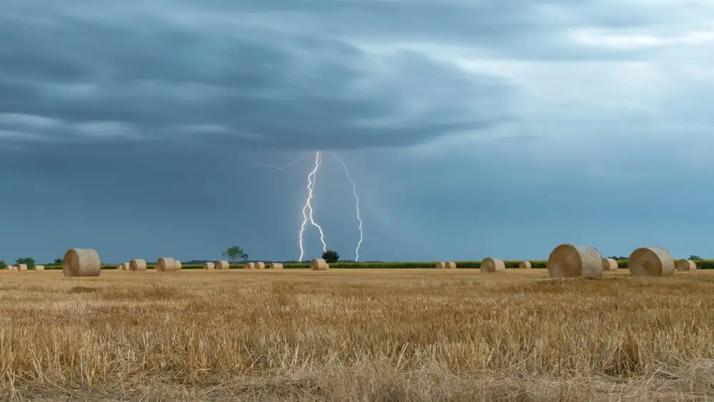
Photograph · source and license
The image, credit, reuse license, editorial context and delivered file are recorded in the exact Sites editorial review. This review is separate from the article’s canonical CIE assessment.
Image and publication standards →In this story
Four questions often hide inside one map search
A resident may ask whether a home is “in the floodplain” when the real concern is insurance, building rules, evacuation, drainage or purchase risk. The effective FEMA map can inform regulation and insurance.
Virginia’s Flood Risk Information System brings additional layers together. A local plan can show roads and facilities.
Current warnings describe an active event. None of those sources answers every question by itself.
This guide is for Altavista, Hurt, Brookneal, Halifax and other communities shaped by rivers and intense rain. It does not determine coverage, set a base-flood elevation, certify a structure or tell someone to stay during a warning.
In an active event, follow official emergency instructions. For a property decision, preserve the map name, panel, date and question that led you there.
Effective hazard zones have a formal job
FEMA’s National Flood Hazard Layer carries effective flood-hazard information used by participating communities. Virginia DCR notes that hardcopy Flood Insurance Rate Maps, the associated database and study are the official designation of special flood hazard areas and base elevations for the federal program.
A web layer is a convenient view of that record, not a substitute for confirming the governing materials.
A line crossing a parcel does not necessarily describe the floor elevation, lowest adjacent grade or exact structure relationship. Zoom level and parcel alignment can mislead.
Before making a financial or construction decision, identify the panel and effective date and ask the appropriate floodplain administrator or qualified professional how the mapped information applies to the structure.
A planning layer can show risk beyond the regulatory line
DCR also publishes planning and flood-resilience information assembled from multiple datasets. Those layers can help communities see rainfall-driven, riverine or future conditions that an effective regulatory map may not display in the same way.
A planning layer should be labeled as planning information. It should not be presented as a newly effective insurance zone unless the responsible authority says so.
The difference is productive rather than contradictory. Regulation needs a defined adopted map; resilience planning can examine wider scenarios.
A household can use both: one to understand current formal requirements and the other to ask whether water could reach roads, outbuildings or drainage paths outside the mapped special hazard area.
“Outside the zone” never means “no flood risk”
Flooding can occur from smaller streams, blocked drainage, intense rainfall, sheet flow, dam incidents or conditions not captured at a map’s scale. VDEM explicitly directs residents to VFRIS for property-risk context and warns that standard homeowner and rental policies generally do not cover flood losses.
The correct insurance question belongs with a licensed provider and the actual policy, not a color on a public map.
Likewise, a prior owner’s statement that water has never entered is a historical claim with an uncertain observation period. It may be useful when documented, but it is not a forecast.
Ask for permits, claims information available through authorized channels, elevation documents and dated repair records. Do not pressure neighbors to disclose private losses publicly.
Elevation needs a reference point
An elevation number is meaningful only with its datum, measurement location, method and relationship to the mapped base flood elevation. Porch height, road height and finished-floor elevation are not interchangeable.
A phone’s altitude display is not an elevation certificate. When a survey or certificate matters, use a qualified professional and preserve the complete signed document.
Older documents may use a different vertical datum or building configuration. A later addition, enclosure or grading project can change the questions even if the map remains the same.
Rather than copying a number into a listing, attach it to its source and date. If conversion is required, let the responsible professional document the method.
Road access is a separate household risk
A house can remain dry while the driveway, bridge or connecting road becomes impassable. Mapping the route to work, school, care and emergency services is therefore part of place-based planning.
Use official road closures and warnings during an event. A planning exercise can note low crossings and alternatives, but it should never encourage driving through water or around a barricade.
Rural routes can also depend on private roads or culverts whose maintenance responsibility is not obvious. Deeds, association records and locality information may answer ownership questions.
A map pin does not establish who must repair a crossing. Keep the access record beside the flood map so the household does not mistake structural risk for total mobility risk.
Repairs leave a chronology that maps cannot
Permits, contractor invoices, photographs and inspection records can show how a building changed after water damage. Their value comes from sequence.
Preserve the pre-repair condition, scope, materials and completion documentation. Do not crop away dates or identify a payment as insurance-funded unless the source establishes that fact.
Private claim documents need careful handling.
When reporting a neighborhood event, aggregate conditions unless a homeowner consents to identification. One flooded basement does not prove every structure on the street flooded, and a dry photographed porch does not prove the building escaped hidden damage.
The newsroom should separate observed conditions, owner accounts and official assessments.
A purchase file should preserve uncertainty
A careful buyer can save the effective map, planning layers, seller-provided documents, permits and professional reports as dated files. The absence of an online item should become a question, not an accusation.
Some records predate digitization or use a former parcel number. A title professional, surveyor, floodplain administrator, insurer or inspector may own different parts of the answer.
Do not rely on an editorial article as a transaction representation. Gretna Junction does not know the condition, coverage or legal obligations of a named property.
The public service is teaching the record stack so readers can recognize when a listing or casual answer collapses several distinct questions into a misleading “yes” or “no.”
An emergency snapshot expires quickly
Rain totals, river stages, warnings and closures change. A screenshot without retrieval time can become dangerous.
During an event, use official current channels and note the issuance and expiration of a warning. Historical gauges and reports are useful afterward, but they should be labeled as retrospective.
A forecast is not an observed crest, and a crest at one gauge is not the water depth at every home.
If power or service is limited, households should use the communication plan they prepared with local emergency guidance. This article does not replace alerts, evacuation orders or dispatcher instructions.
Publishing a stable explainer beside changing emergency information helps readers tell durable map concepts from conditions that require immediate verification.
The strongest record is a layered one
A good property note lists the effective FEMA source, the Virginia planning source, any elevation document, locality contact, observed history and current warning channel. It states what each item cannot establish.
That may feel less decisive than a single color-coded screenshot, but it is much more useful when a resident speaks with an insurer, contractor or official.
Flood risk is not a label placed on a household; it is a set of physical, regulatory and financial questions that change over time. Keeping those questions separate supports honest home decisions and better public planning.
It also leaves a clear correction path when a map, structure or policy changes.
Sources & verification
Official state mapping entry point; layers must be read with their dates and purposes.
Read the sourceOfficial guide supporting the distinction between effective FEMA layers and other flood information.
Read the sourceFederal source for effective flood-hazard mapping; no parcel determination is made here.
Read the sourceOfficial preparedness source for current warnings, VFRIS and flood-insurance context.
Read the sourceThis article was written with AI assistance from the linked sources. No firsthand interview or visit is implied. Source dates and limits are identified in the reporting. Advertising does not determine editorial coverage. Request a correction or read our standards.
EVERY NEIGHBOR HAS A VOICE
Keep the conversation going.
Share experiences, ask questions and link evidence for factual claims. Automated publication checks apply to each submitted version. Comments are independent community discussion, not submissions to a government body.
Sign in to join · freeCommunity standards