
Feature Conservation · Virginia
Smith Mountain Lake is an engineered landscape with a living watershed
The hydroelectric project created a vast reservoir and new recreation economy, but conservation begins by remembering the rivers, land and operating rules beneath the familiar shoreline.
Checking whether this browser can read the story aloud.
Explore related topics
Sources & editorial review
Sites editorial review recorded for this exact revision. This AI-assisted article or learning resource includes source links and credited contextual imagery.
This is a local editorial review, not a canonical Cultural Imprint Engine assessment. No CIE score is claimed. Source review does not verify third-party playback, provider availability or image pixels.
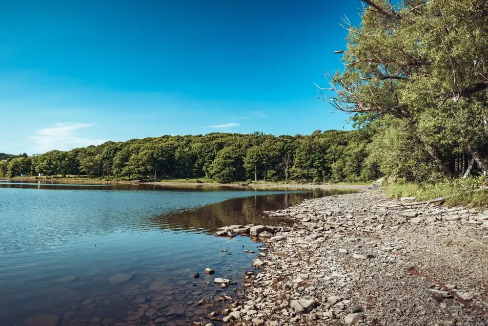
Photograph · source and license
The image, credit, reuse license, editorial context and delivered file are recorded in the exact Sites editorial review. This review is separate from the article’s canonical CIE assessment.
Image and publication standards →In this story
A lake made by infrastructure
Virginia State Parks explains that Smith Mountain Lake was created when Appalachian Power built a dam on the Roanoke River at Smith Mountain Gap. The project is a two-reservoir hydroelectric system involving Smith Mountain and Leesville lakes.
That origin distinguishes the waterbody from a natural lake whose basin developed without a modern dam. The shoreline, coves and open water now feel established, but they resulted from engineering decisions, land acquisition, construction and inundation.
Calling the lake engineered is not a criticism. It is the necessary first fact for understanding who operates water-control structures, why levels can change, how power generation interacts with recreation, and why shoreline rules differ from ordinary property expectations.
The watershed is larger than the view
Water reaching the lake carries the history of upstream land. Rain moves across farms, roads, forests, construction sites and neighborhoods before entering creeks and river arms.
Sediment, nutrients, bacteria, litter and other contaminants do not respect county lines or waterfront property boundaries. Conservation therefore cannot be reduced to keeping one dock tidy.
It involves land practices throughout the watershed, wastewater and septic performance, erosion control, stormwater, riparian vegetation and careful use of fertilizers and chemicals. Conditions also vary by location and time; one sample cannot characterize the whole reservoir.
Residents need dated monitoring from responsible programs and should avoid inferring safety from water clarity alone.
Operating a project means balancing constraints
Appalachian Power operates the Smith Mountain Project under a federal license. Hydroelectric generation moves water through the system, while license conditions and public responsibilities address flows, recreation, environmental resources and shoreline management.
Drought, storms, maintenance and downstream needs can complicate the picture. A historical normal is not a guarantee for a particular weekend.
The operator’s lake-level information is the appropriate source for current conditions, but even a posted elevation does not certify a cove’s depth, a ramp’s usability or the absence of underwater hazards. Boaters and property owners should separate systemwide data from local observations and follow current official notices.
This article records the project’s structure; it is not an operations alert.
Public recreation came through another layer
Smith Mountain Lake State Park occupies land connected to the project’s development and gives the public access to camping, trails, swimming and boating opportunities. The park’s history shows how hydroelectric infrastructure and recreation were linked after the reservoir was created.
Public access, however, is managed rather than automatic. Hours, fees, swim areas, trail conditions and boat facilities can change.
Conservation at a heavily used lake includes visitor behavior: cleaning up waste, respecting closures, preventing fuel spills, reducing shoreline erosion and avoiding transport of invasive species. It also means recognizing that much shoreline is private and that a view from the water does not grant entry.
Rights, safety and stewardship reinforce one another.
Read the lake through accountable sources
For a current outing, check the park and project operator, then consult weather and emergency notices. For a shoreline project, use the governing permit process rather than copying a neighbor’s structure.
For environmental claims, look for sampling methods, dates, locations and responsible agencies. Long-term conservation requires cooperation among residents, local governments, the operator, state agencies and watershed organizations, but cooperation should not blur accountability.
Each institution has a defined role and evidence standard. Smith Mountain Lake’s history offers a practical lesson: the landscape is both a public amenity and operating infrastructure.
Protecting it requires attention to the entire watershed and to the rules that keep a shared, constructed system functioning.
Shoreline decisions accumulate
One dock, retaining wall or cleared slope may seem small beside a large reservoir, but repeated alterations can change habitat, erosion and the visual character of coves. Permitting systems address that cumulative reality by requiring review under current rules.
Property owners should not infer permission from an older neighboring structure because it may predate a rule, have different site conditions or lack lawful status. Vegetated buffers and erosion-control practices can protect water while still allowing appropriate access.
The right design depends on slope, soil, wave exposure and jurisdiction. Qualified advice and official review are more reliable than a social-media photograph without location or date.
Monitoring needs transparent methods
A credible water-quality claim identifies who collected a sample, where and when it was taken, what method and laboratory were used, and what comparison standard applies. A volunteer program can provide valuable long-term coverage when protocols and quality controls are clear.
Agency sampling may answer a narrower regulatory question. Neither should be reduced to a color-coded headline stripped of context.
Trends are usually more informative than one result, and gaps should remain gaps rather than being filled by inference. Residents can support conservation by reading the metadata, asking what the measurement can actually establish and resisting claims that transform a limited sample into a verdict on the entire lake.
The history of inundation belongs in conservation too. Farms, roads and familiar places occupied portions of the valley before water covered them.
Research should use land records, maps, archaeology and consented family accounts rather than romantic speculation about what lies below. That earlier landscape is not an argument that the present lake is unreal; it is evidence that environmental history includes human decisions and displacement.
Remembering it makes stewardship less superficial because the water’s benefits and costs can be discussed together.
What the record still asks
Climate and land-use change make historical baselines harder to use mechanically. A past operating range or shoreline condition may not predict future rainfall, demand or runoff.
Planning should use current engineering and environmental evidence while preserving older data for comparison. Residents do not need to choose between enjoying the lake and asking how the system adapts.
Recreation, power, habitat and downstream flows are connected through the same water. Public explanations are strongest when tradeoffs, uncertainty and the authority for each decision are visible.
Sources & verification
Official park overview and history of the lake’s creation.
Read the sourceOfficial project explanation and hydroelectric context.
Read the sourceOfficial state wildlife and fisheries overview.
Read the sourceThis article was written with AI assistance from the linked sources. No firsthand interview or visit is implied. Source dates and limits are identified in the reporting. Advertising does not determine editorial coverage. Request a correction or read our standards.
EVERY NEIGHBOR HAS A VOICE
Keep the conversation going.
Share experiences, ask questions and link evidence for factual claims. Automated publication checks apply to each submitted version. Comments are independent community discussion, not submissions to a government body.
Sign in to join · freeCommunity standards