
Explainer Conservation · County
A Brodnax flood or stream claim needs a gauge, map, field method and dated local record
Watershed boundaries, flood maps, stream gauges and observations describe different scales. Connecting them prevents a single storm photo or regional forecast from becoming a false local trend.
Checking whether this browser can read the story aloud.
Explore related topics
Sources & editorial review
Sites editorial review recorded for this exact revision. This AI-assisted article or learning resource includes source links and credited contextual imagery.
This is a local editorial review, not a canonical Cultural Imprint Engine assessment. No CIE score is claimed. Source review does not verify third-party playback, provider availability or image pixels.
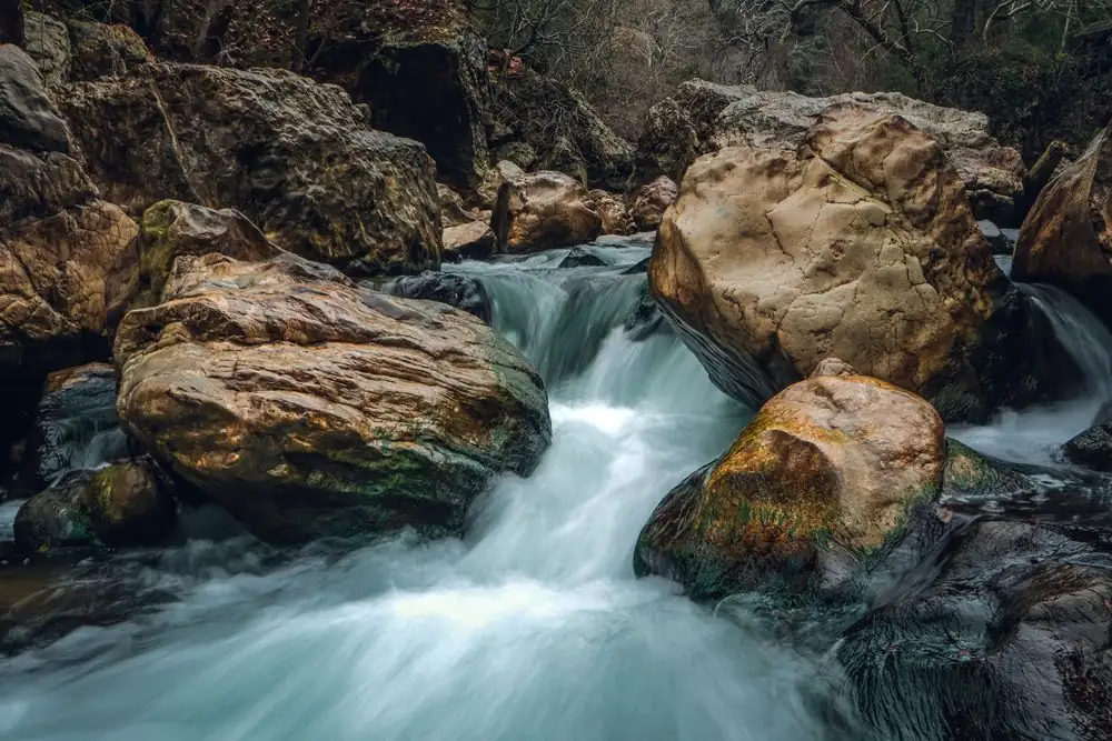
Photograph · source and license
The image, credit, reuse license, editorial context and delivered file are recorded in the exact Sites editorial review. This review is separate from the article’s canonical CIE assessment.
Image and publication standards →In this story
Define the question before opening a dashboard
Which records can support a local statement about stream level, flood exposure or watershed condition around Brodnax? For Brodnax and the Brunswick–Mecklenburg area, that question needs a place, a period, a responsible institution and a definition of what would count as evidence.
This guide treats a watershed or flood claim as a chain of records rather than a single number or search result. The aim for this a watershed or flood claim inquiry is not to manufacture a verdict.
It is to make the Brodnax and the Brunswick–Mecklenburg area question reproducible, fair and correctable.
For Brodnax and the Brunswick–Mecklenburg area, geography is part of the method: The incorporated town, county line, drainage basin, mapped flood zone and gauge catchment are different geographies. A postal label, service territory, county aggregate or regional program can be useful context for a watershed or flood claim, but it cannot silently become proof about the locality named in a headline.
Record the geographic unit used by every a watershed or flood claim source before comparing values or describing access in Brodnax and the Brunswick–Mecklenburg area.
Forecast, observed, mapped, sampled, declared and recovered are separate states. Dates in the Brodnax and the Brunswick–Mecklenburg area record should identify when a record was created, the period it describes and when it was checked.
A current webpage about a watershed or flood claim can host an older report; a newly posted document can describe a completed fiscal year; and an application portal can remain online after a particular opportunity closes. Those a watershed or flood claim clocks must remain visible.
Build the evidence chain one record at a time
1. stream-gauge observation is maintained by the U.S. Geological Survey or named monitoring agency.
The stream-gauge observation record's useful role is to report a measured value, station identity and timestamp. The stream-gauge observation limit is equally important: one station does not describe every tributary or future condition and may carry provisional data.
For stream-gauge observation, capture the official title, issuing body, covered dates, retrieval date and direct URL. If the stream-gauge observation custodian later replaces or corrects the record, preserve its earlier citation and add a dated revision note instead of silently rewriting history.
2. flood-hazard map is maintained by the Federal Emergency Management Agency. The flood-hazard map record's useful role is to show the mapped regulatory hazard area and map effective date.
The flood-hazard map limit is equally important: it is not a live forecast, parcel survey or guarantee that flooding will or will not occur. For flood-hazard map, capture the official title, issuing body, covered dates, retrieval date and direct URL.
If the flood-hazard map custodian later replaces or corrects the record, preserve its earlier citation and add a dated revision note instead of silently rewriting history.
3. field sampling record is maintained by the Virginia Department of Environmental Quality or named monitoring program. The field sampling record record's useful role is to document a method, site, analyte and collection time.
The field sampling record limit is equally important: a sample is a bounded observation and cannot establish basin-wide condition by itself. For field sampling record, capture the official title, issuing body, covered dates, retrieval date and direct URL.
If the field sampling record custodian later replaces or corrects the record, preserve its earlier citation and add a dated revision note instead of silently rewriting history.
4. local incident or infrastructure record is maintained by the responsible local or state agency. The local incident or infrastructure record record's useful role is to document a dated closure, damage report or public action.
The local incident or infrastructure record limit is equally important: an incident report does not establish long-term frequency, cause or current road status. For local incident or infrastructure record, capture the official title, issuing body, covered dates, retrieval date and direct URL.
If the local incident or infrastructure record custodian later replaces or corrects the record, preserve its earlier citation and add a dated revision note instead of silently rewriting history.
Keep identity, authority and outcome separate
For a watershed or flood claim, an identity record answers who or what is registered. An authority record in Brodnax and the Brunswick–Mecklenburg area answers which office may approve, regulate, fund or enforce.
An activity record for a watershed or flood claim shows that something was filed, discussed, inspected, advertised or measured. An outcome record for Brodnax and the Brunswick–Mecklenburg area documents what actually happened. a watershed or flood claim becomes misleading when those stages are collapsed into one label such as approved, verified, funded, safe, successful or available.
For Brodnax and the Brunswick–Mecklenburg area, create a four-column worksheet for identity, authority, activity and outcome. Place each a watershed or flood claim source in only the column it actually supports, then note unresolved links.
In this Brodnax and the Brunswick–Mecklenburg area inquiry, a registration does not prove performance; an appropriation does not prove expenditure; a posting does not prove a hire; a sample does not describe every day; and a meeting statement is not an adopted action. That a watershed or flood claim discipline prevents official-looking documents from lending certainty they do not contain.
The a watershed or flood claim worksheet should also preserve negative space. If no Brodnax and the Brunswick–Mecklenburg area source publishes a deadline, salary, service boundary, sample method or implementation date, write “not supplied” rather than inventing a likely answer.
If a a watershed or flood claim source is temporarily inaccessible, mark verification pending and retain the last valid checked date. A timeout in the Brodnax and the Brunswick–Mecklenburg area review is not evidence that the underlying program, position or condition ended.
Read the records together without forcing agreement
Identify the exact waterbody and drainage area before comparing values. Similar stream names and nearby gauges can describe different catchments, especially near a county boundary.
Preserve time zones, provisional flags and station identifiers. A screenshot without those fields can make yesterday's crest look like a current reading and should never drive a live safety instruction.
Use the effective flood map for regulatory context and the responsible forecast source for changing conditions. Neither substitutes for a site survey, evacuation order or closed-road notice.
A trend claim needs consistent method and interval. Photographs and resident reports can identify a lead, but repeated measurements under a documented protocol are required before describing water quality or flood frequency.
Work a documented local example
After a storm, a public gauge shows a rapid rise at a named station. The article records its timestamp, provisional status and drainage context rather than calling every Brodnax road flooded.
A FEMA map supplies long-term hazard context, while a local closure notice documents one affected route and period. The two records are linked but not blended into a single live map.
If a water-quality sample is relevant, its method, site and units are recorded separately. The article avoids diagnosing a cause from color, odor or one photograph.
The evergreen guide points readers to official live destinations and preserves the checked date. It does not remain styled as an alert after the event or promise that an unlisted road is safe.
Avoid the errors that make a polished page unreliable
Pitfall 1 for Brodnax and the Brunswick–Mecklenburg area: using a nearby gauge without naming its watershed and station. The repair for pitfall 1 is to return to the underlying a watershed or flood claim record, name its creator and purpose, and show the smallest claim it can support.
If the Brodnax and the Brunswick–Mecklenburg area comparison changes after repairing pitfall 1, preserve both the earlier statement and the correction date so readers can see why the interpretation moved.
Pitfall 2 for Brodnax and the Brunswick–Mecklenburg area: presenting a FEMA hazard map as a current flood forecast. The repair for pitfall 2 is to return to the underlying a watershed or flood claim record, name its creator and purpose, and show the smallest claim it can support.
If the Brodnax and the Brunswick–Mecklenburg area comparison changes after repairing pitfall 2, preserve both the earlier statement and the correction date so readers can see why the interpretation moved.
Pitfall 3 for Brodnax and the Brunswick–Mecklenburg area: calling one photo or sample a long-term conservation trend. The repair for pitfall 3 is to return to the underlying a watershed or flood claim record, name its creator and purpose, and show the smallest claim it can support.
If the Brodnax and the Brunswick–Mecklenburg area comparison changes after repairing pitfall 3, preserve both the earlier statement and the correction date so readers can see why the interpretation moved.
Pitfall 4 for Brodnax and the Brunswick–Mecklenburg area: inferring that a road is open because an old closure notice disappeared. The repair for pitfall 4 is to return to the underlying a watershed or flood claim record, name its creator and purpose, and show the smallest claim it can support.
If the Brodnax and the Brunswick–Mecklenburg area comparison changes after repairing pitfall 4, preserve both the earlier statement and the correction date so readers can see why the interpretation moved.
Ask for missing records narrowly and safely
A productive a watershed or flood claim request names an existing record rather than asking an office to answer a broad research question. For Brodnax and the Brunswick–Mecklenburg area, useful targets include the exact gauge metadata and observations; the effective flood-map panel and date; the sampling method and result table; the dated local closure or incident record.
Give the a watershed or flood claim request a bounded date range, preferred electronic format and a request to discuss cost before expensive work begins. The responsible Brodnax and the Brunswick–Mecklenburg area agency generally does not have to create a new record merely because a requester would prefer a custom analysis.
Request the least sensitive a watershed or flood claim version that can answer the question. Do not expose private access routes, household details, security information or sensitive habitat locations beyond what a responsible public source releases.
Aggregate Brodnax and the Brunswick–Mecklenburg area data may still expose people when the group is very small or the variables are unusually specific. Remove names, exact home addresses, student or patient identifiers, private contact information and narrative details from the a watershed or flood claim request unless disclosure is both lawful and genuinely necessary for the public-interest question.
For the Brodnax and the Brunswick–Mecklenburg area inquiry, keep the request, acknowledgment, estimate, clarification, production and appeal or correction steps together. A a watershed or flood claim fee estimate is not a completed production.
A Brodnax and the Brunswick–Mecklenburg area redaction is not automatically concealment; ask for the cited legal basis and a segregable nonexempt portion. When another office owns the a watershed or flood claim record, document the referral and continue with the proper custodian rather than treating the first office as nonresponsive.
Compare numbers only after aligning their denominators
Before calculating a a watershed or flood claim rate for Brodnax and the Brunswick–Mecklenburg area, write the numerator in plain language, the denominator in plain language, the covered period and the geography. Check whether the Brodnax and the Brunswick–Mecklenburg area records are preliminary, amended, audited, seasonally adjusted, suppressed or rounded.
Two a watershed or flood claim percentages can share a label while measuring different populations. Counts in Brodnax and the Brunswick–Mecklenburg area can rise because reporting improved, eligibility widened or a boundary changed, not because the underlying condition necessarily worsened.
Use totals beside rates and show missingness in the Brodnax and the Brunswick–Mecklenburg area record. A small Brodnax and the Brunswick–Mecklenburg area population can experience a large percentage swing from a few cases, filings, samples or participants.
A statewide or regional a watershed or flood claim benchmark can provide context, but it should not erase the local scale. When a watershed or flood claim source definitions change, break the series or restate it under one documented method rather than drawing a smooth trend through incompatible years.
If an official a watershed or flood claim source amends its table, retain the amendment date and rerun the calculation once. Do not count copies of the same a watershed or flood claim release as independent corroboration.
A Brodnax and the Brunswick–Mecklenburg area press release, dashboard and meeting slide may all descend from one dataset. True a watershed or flood claim corroboration comes from a separately created record or a transparent reconciliation of the common source.
Give affected institutions a fair response opportunity
Before publishing a material criticism about a watershed or flood claim in Brodnax and the Brunswick–Mecklenburg area, send the responsible office the exact source, period, calculation and proposed wording. Ask focused a watershed or flood claim questions about definitions, known errors, amendments and relevant context.
Provide the Brodnax and the Brunswick–Mecklenburg area office a meaningful deadline and record whether it answered, declined, disputed the method or requested more time. Silence in the a watershed or flood claim review does not prove the criticism, and a response does not erase the underlying record.
Social posts and neighborhood conversations about Brodnax and the Brunswick–Mecklenburg area can identify a watershed or flood claim leads, but they remain attributed and unverified until supported. Do not republish a private person’s a watershed or flood claim records, accusation or location merely because it appeared publicly.
The Brodnax and the Brunswick–Mecklenburg area article should explain which claims were independently checked, which remain unresolved and what evidence would change the conclusion.
A a watershed or flood claim correction is required when a station, map panel, sample method, road status or official incident record changes. Preserve the Brodnax and the Brunswick–Mecklenburg area publication date, identify the changed claim, link the stronger evidence and update affected summaries, structured metadata and discovery shelves.
A a watershed or flood claim correction trail is part of the product, not an embarrassment to hide.
Turn the research into a useful reader action
End the Brodnax and the Brunswick–Mecklenburg area guide with a direct official destination and a specific next step. Readers of the a watershed or flood claim guide should know whether they are checking a record, requesting assistance, commenting on a proposal, applying through an official portal or monitoring a future decision.
Do not imply that Gretna Junction receives a Brodnax and the Brunswick–Mecklenburg area application, schedules a service, grants a license, resolves a bill or speaks for the responsible agency.
The public a watershed or flood claim page should retain its checked date, locality, source geography, free-access label, reading estimate and image credit. Its Brodnax and the Brunswick–Mecklenburg area illustration may explain the evidence path, but it must not masquerade as an official map, current condition, regulated notice or firsthand photograph.
Accessibility for this a watershed or flood claim guide requires readable text, keyboard-reachable actions, descriptive links and a full article that remains usable even when optional audio is unsupported.
The durable a watershed or flood claim result is a record readers can repeat: the question, the source chain, the aligned dates and geography, the calculation, the response, the limits and the next evidence event.
That structure lets Brodnax and the Brunswick–Mecklenburg area residents use a watershed or flood claim without being pushed toward false certainty, private disclosure or a generic checklist detached from local institutions.
Sources & verification
Official federal gauge observations, station metadata and provisional-data context.
Read the sourceOfficial federal route for effective flood-hazard maps and products.
Read the sourceOfficial Virginia water monitoring and regulatory program information.
Read the sourceOfficial county destination for current local contacts and notices.
Read the sourceThis article was written with AI assistance from the linked sources. No firsthand interview or visit is implied. Source dates and limits are identified in the reporting. Advertising does not determine editorial coverage. Request a correction or read our standards.
EVERY NEIGHBOR HAS A VOICE
Keep the conversation going.
Share experiences, ask questions and link evidence for factual claims. Automated publication checks apply to each submitted version. Comments are independent community discussion, not submissions to a government body.
Sign in to join · freeCommunity standards